American River Fishing Spot
- Elevation: 268'
- Last Modified By: vinny60 on 09/08/09 02:04 PM
- Ask about American River in our Fishing Forums
Photos
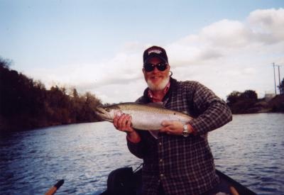
Fish Species
Comments
-
Have you fished at American River? Be the first to comment on this fishing spot.
American River Description
The America River is an American favorite: more than 100,000 people float just the South Fork of the river every year, making it the most popular stretch of whitewater in the state of California. The river offers great scenic beauty, thrilling whitewater excitement and a motherlode of mining and American history. The North and Middle Forks present greater challenges to the rafter, while the rapids of the South Fork, although abundant, are less turbulent.
To boaters, the South Fork of the American River brings to mind long and lazy pools, perfect for escaping the summer's heat, the parade of rapids down through "The Gorge", and surfing the waves and holes at Triple Threat Rapids. But look beyond the white water, and you will find much more than a wonderful river trip. Much of California history is reflected in the river's journey west, from the snow-covered peaks of the Crystal Range through the Motherlode, to Folsom Lake.
In recent years, the evolving concept of river use has resulted in water releases from Folsom Lake, to maintain the water quality in the Sacramento River Delta, and to support fall runs of salmon.
Today, the river is a great recreational resource as well. More than 2 million people visit Folsom Lake State Recreation Area each year. Many thousands enjoy the scenery along Highway 50, as they travel through the Sierras to Lake Tahoe. And the whitewater stretch from Chili Bar to Folsom Lake has become the most popular in California.
Directions: From Auburn, on Hwy I-80; go NE, 2 mi. to Auburn-Foresthill Rd. Turn E, go 18 mi. to Foresthill. Continue on Forest Hill-Soda Springs Rd., go 12 mi. to Forest Rd. 66. 1) Turn L, go 3 mi. to Italian Bar trailhead. 2) Go 3 mi. beyond Rd. 66, turn L at Mumford Bar trailhead. 3) Go 5 mi. beyond Mumford Bar turnoff to Beacroft trailhead. Access upper reaches from Soda Springs Rd. S of Hwy I-80. Most trails 3-4 mi. and drop about 2,000 ft.
A designated wild trout water from Iowa Hill Rd. bridge to Palisade Creek. Very clear stream in remote, very steep canyon, moderate in gradient, mixed large bedrock pools, riffles, and boulder field pocket water; vegetation varies from foothill oak woodland through yellow pine belt. Watch for rattlesnakes. Campgrounds near trailheads.
The American River (Río de los Americanos in the Mexican period) located in the US state of California, has a prominent place in United States history for being the site of Sutter's Mill, Northwest of Placerville, California, where gold was found in 1848, leading to the California Gold Rush. It runs from the Sierra Nevada mountains through the Sacramento metro where it flows into the Sacramento River on its way to San Francisco Bay. It is known for its whitewater rapids.